Inner Loop and Outer Loop of the Beltway Meaning.
Anonymous
You really need to come back and explain this post. More than half the posts on this thread make it perfectly clear that the portion of the beltway we call the "outer loop" includes the portion that runs from College Park to Bethesda. Why do you feel that makes no sense? I honestly want to understand your thinking. |
Anonymous
This. In many major metro areas there are multiple beltway-style highways. Typically, "inner loop" means the highway closest to the downtown. And "outer loop" is the further highway. In DC itself, there were originally plans for two circular highways, with the "inner loop" centered on downtown DC and the White House directly in the middle. This was scrapped, but only after a few portions were already built. It would've included a highway on the National Mall! https://en.wikipedia.org/wiki/Inner_Loop_(Washington,_D.C.) In other major cities where you have three or more beltway-style loops, they are called "ring roads." You'll reference the road closest to you by saying "I live near the 4th ring." Beijing is now on it's 6th ring road, with plans for a 7th IIRC. 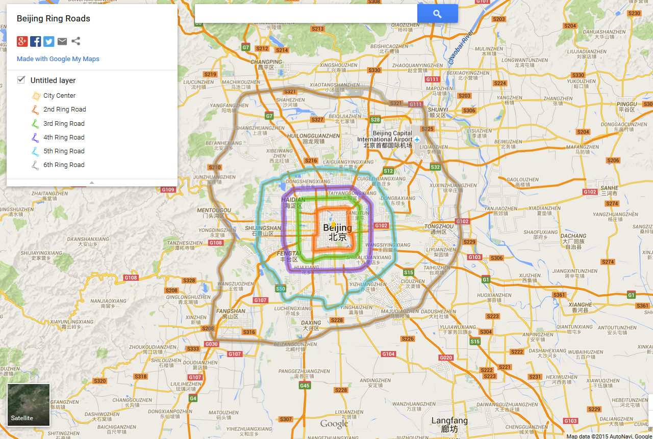
|
Anonymous
here is an explanation https://en.wikipedia.org/wiki/Inner–outer_directions |
Anonymous
You are focusing much too narrowly. Effectively, you are only thinking of about 1/8 of the entire beltway. Here's a picture: 
The outer loop of the Beltway is the side of the highway that travels around the city counter-clockwise. It is further from the city center and is outside the inner loop. The inner loop of the Beltway is the side of the highway that travels around the city clockwise. It is closer to the city center and is inside the outer loop. So, the outer loop will go from College Park to Bethesda, to McLean, to Alexandria, to Camp Springs to Upper Marlboro and back to College Park. The inner loop will go the other direction, from College Park to Upper Marlboro, Camp Springs, Alexandria, McLean, Bethesda and then back to College Park. Hopefully this helps you visualize why they are inner and outer loops. |
Anonymous
|
After 3 pages what am I missing?:
Inner Loop - Clockwise Outer Loop - Counter-Clockwise Is there anything more? |
Anonymous
|
I drove professionally when I moved to this area. It took me about 3 years to understand the terms, even though I knew all the paper maps, inside and out.
When I finally got it, I was like “duh! Of course, that’s what it means!” |
Anonymous
| Is there housing or retail between the two loops? I understand houses “inside the beltway” fetch more money. |
Anonymous
Huh? I will assume this was a clown question. |
Anonymous
I take it you don't drive in this area. |
Anonymous
It is two sides of the same road. It is a divided highway. No businesses between the two sides of the highway. There are places where this is a median or where the sides separate due to elevated on and off ramps, but this is what the majority of the two loops look like: 
The inner loop is the right side driving away from the camera. The outer loop is the left side driving towards the camera. |
Anonymous
Many US cities were going to get a inner loops/spurs, but some white neighborhoods revolted. Today nearly all of those neighborhoods that rejected highways are the most valuable and desirable real estate. |
Anonymous
| The curves near Chevy Chase are really to slow people down? |
Anonymous
This is a great picture but you can't tell which is the outer and which is the inner just looking at it. You'd need to know that the lanes on the right are going North from Tysons to Virginia... or south from College Park to Alexandria... or whatever. You're going to confuse OP if they think you can know which side it which looking at the picture. Also, where are there separated lanes like in the right of the picture? Are you sure that's not 270 with the local lanes? |
Anonymous
| What about the fruit loop? Where is that? |
Anonymous
I’m from NJ originally and they have rest stops between the southbound and northbound lanes. Starbucks and fast food and gas stations. |