Just IN!!!! Youtube video of Boundary Analysis Discussion / Board of Education Jan. 9, 2020
Anonymous
Incorrect. Around 30% DO NOT go their closest school. If you keep peddling misinformation, you will lose all credibility. |
Anonymous
Agreed. I think the boe has an obligation to demonstrate that we need to change boundaries because many of the boundaries are gerrymandered and it's creating overcrowding |
Anonymous
I'm still confused by what the word means to the BOE. |
Anonymous
And what exactly was the purpose of adding that word ESPECIALLY if it wasn't to amplify it's priority over the others? Again watch the board of Ed video on April 2018 , sep 13, 2018 and sep 24 2018. The words coming out of the Board of Ed members are truly eye opening. |
Anonymous
Sorry but 60%+ do not attend the closest school according to the county. |
Anonymous
You are incorrect. Look at the images here and you can see it is 30-45% https://mobile.twitter.com/CaitlynnPeetz14/status/1216003644925075457 |
Anonymous
I saw the data provided by the county last week. It was posted in another thread. Don't really get why the one parent keeps trying to deny it. |
Anonymous
|
Tried to quote/ copy the PP's posting with gerrymandered maps of GHS and QO. These are exactly a result of past attempts to zone based on diversity and income. QO has the weird shape because MCPS did not want it to be entirely white and low FARMS. They included Brown Station and sent the Diamond elementary school to NW to balance out numbers in NW. If you rationalize QO then it becomes the next less than 10% FARMS school and NW becomes a high FARMS school.
GHS boundaries also represent trying to balance what was once the poor and MC areas of Gaithersburg. Believe it or not but Montgomery Village and the areas up to the north used to primarily non FARMs and white. The areas are now are much more low income but the weird section to the north is still MC/UMC white. Again if you rationalize GHS it stays low income and potentially increases. Wootton's only strange boundary area is the small island up in RIO. Most people in Wootton don't even know that this small section zones to Wootton. No idea how it got into Wootton. People in the west and upcountry would be perfectly fine with local boundaries in normal shapes but this is going to end up going in the opposite direction of racial balancing and diversity. |
Anonymous
It's like you're citing the Federalist Papers or something. Policy FAA does not say that the demographic factor is the most important, regardless of what former Board of Education members may or may not have said in 2018. |
Anonymous
All of Wootton's boundary is strange. It's width is 4X it's height. These are boundaries are obviously gerrymandered. |
Anonymous
Here it is again, people. Note how the chart shows "total students who do not attend closest school" and the figures are all within the range of 37-45%. 
|
Anonymous
The only thing odd about Wootton's boundaries is that Horizon Hills or Falls Grove don't go there but again those moves were down to send UMC white kids to schools to RM back when RM was much higher farms. You could argue that the Potomac kids south of Wootton's boundaries should go to Wootton not Churchill but the density is really, really low and its all wealthy white kids in that area anyway so there is nothing to gain from changing this. |
Anonymous
Do you have link or the title and where to look for it? YouTube? |
Anonymous
LOL.. you think??? I guess if you only try you can see more then just that. Take another GOOD look at the Wootton boundaries and ask yourself the following: 1. Where is the school located? 2. Is it centrally located within the boundaries to provide for optimal commute time and distance? 3. How in heaven this slice of boundary area that is not even connected to the rest of the boundary belong to Wootton? 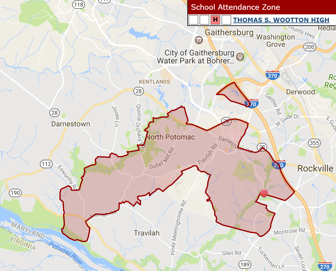
|
Anonymous
What do the ES boundaries look like? |